

PRECISION. DISCIPLINE. INTELLIGENCE —
About Vantage Geo Intelligence
Vantage Geo Intelligence delivers professional aerial intelligence, geospatial analysis, and evidence-grade mapping solutions designed to support confidence decision-making.
Our mission is to transform complex spatial data into clear, actionable intelligence for construction, infrastructure, inspections, and operational environments.
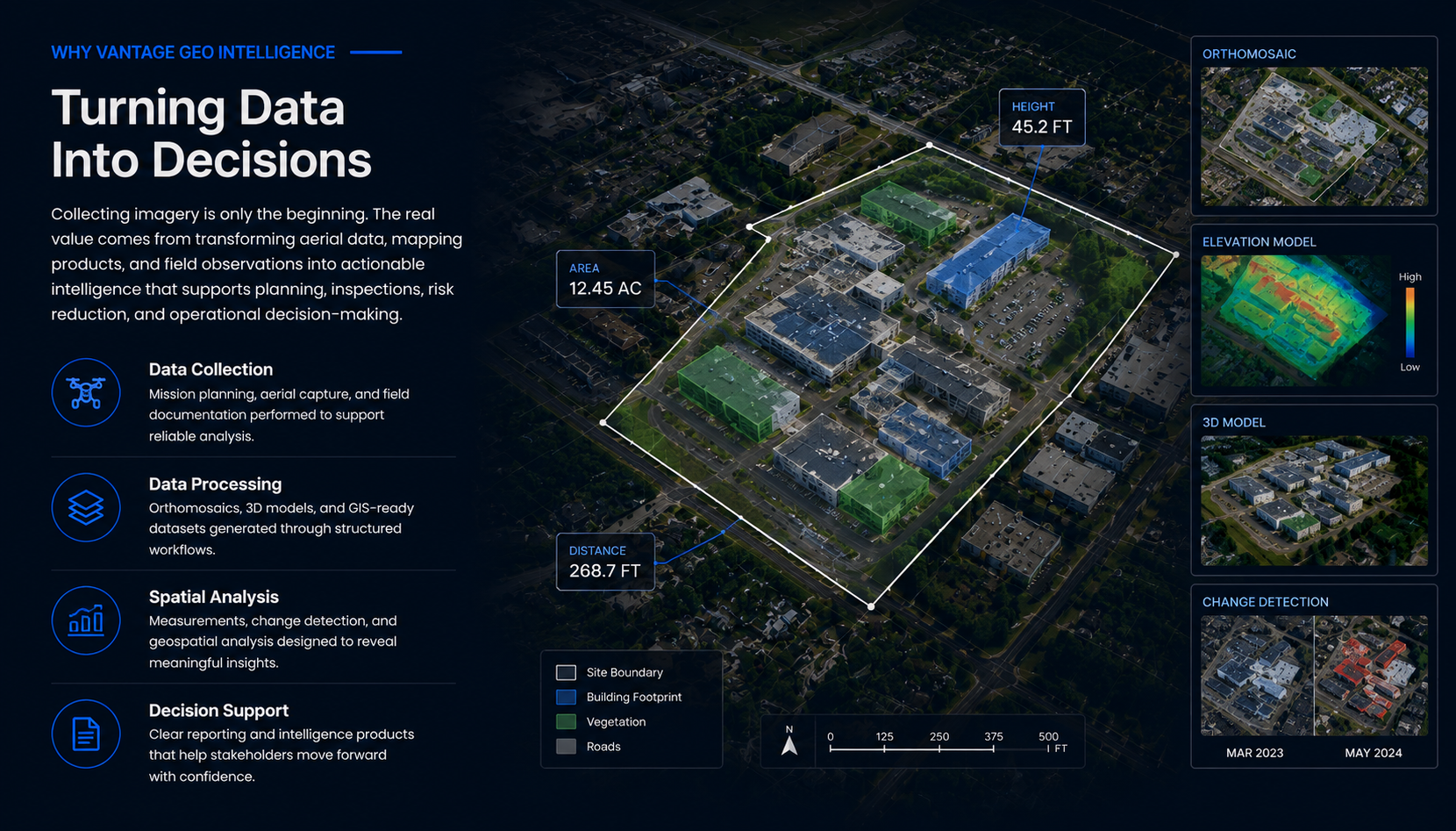
WHY VANTAGE GEO—
Build For Operational Clarity
Decision-First
evidence- Grade
Operational Discipline
About Vantage Geo Intelligence
Clear information for real-world decisions.
Vantage Geo Intelligence is a Northern Virginia drone and geospatial services company focused on practical site documentation and GIS-ready information.
Every engagement begins with the decision a client needs to make. We then plan the capture, analysis, and deliverables around that goal.
Request a Site Documentation QuoteWho we are
Professional field capture. Structured delivery.
VGI combines unmanned aircraft operations, GIS workflows, photogrammetry, remote sensing, and disciplined project management to turn current aerial imagery into organized information that teams can review, share, and use for planning.
Decision-first
We clarify the site question, intended use, access requirements, and deliverable format before work begins.
Traceable documentation
Imagery, maps, observations, and project records stay organized so teams can understand what was collected and how it should be used.
Responsible operations
Flights are conducted by an FAA Part 107-certified remote pilot and planned around safety, airspace, privacy, and site constraints.
How we work
Built for clarity and accountability.
Our working principles are integrity, safety, professionalism, accountability, and continuous improvement.
Typical deliverables
Useful formats for planning and communication.
Start with the site question
Tell us what you need to document.
Share the location, objective, timing, and preferred deliverables. VGI will review the request and recommend a practical next step.
Every mission begins with understanding the decision the client needs to make.
Our focus is on actionable intelligence rather than simple drone imagery. Every project is approached with operational discipline, structured workflows, and attention to accuracy, traceability, and professional reporting
Deliverables are structured for traceability, defensibility, and clarity.
Standardized workflows ensure consistency, reliability, and quality control.
Platform independence
Data ownership and analytical fixability remain central to every project.
Advanced Processing
Industry-leading photogrammetry and data refinement.
Focus On Intelligence
Client Satisfaction
Acres Mapped